Research Fellow
University of Napoli Federico II, Department of Electrical Engineering and Information Technology
I received the B.Sc. in Aerospace Engineering, the M.Sc. in Aerospace and Astronautical Engineering and the Ph.D. in Electronic and Telecommunication Engineering from University of Napoli Federico II in 2009, 2012, and 2016, respectively. Since 2012 I was with the Department of Electrical Engineering and Information Technology, University of Napoli Federico II, working on synthetic aperture radar (SAR) remote sensing. In particular, my research interests are in multitemporal SAR, data fusion, classification, remote sensing techniques for developing countries, and machine learning. Since 2012, I was involved in several research project, especially on railway monitoring and water resource management in semi-arid environment. I am an invited reviewer for several scientific journal, among which: IEEE Transactions on Geoscience and Remote Sensing, IEEE Geoscience and Remote Sensing Letters, International Journal of Remote Sensing, European Journal of Remote Sensing, and Remote Sensing Letters. Outside the office, I enjoy digital photography, Carribean dance, running, and writing. I dedicate some of my spare time to volunteerism. In the past, I collaborated with a no-profit association opertating in a low-income inner city quarter of Napoli as a tutor for children of the primary and secondary school. Moreover, I was an operator for a Catholic association aiding homeless. I am a member of Engineers Without Borders.
University of Napoli Federico II, Department of Electrical Engineering and Information Technology
University of Napoli Federico II, Department of Electrical Engineering and Information Technology
Ph.D. in Electronic and Telecommunication Engineering
University of Napoli Federico II
Master's Degree in Aerospace and Astronautical Engineering
University of Napoli Federico II
Bachelor's Degree in Aerospace Engineering
University of Napoli Federico II

In 2017, I was one of the promoter of one of the winning ideas of the ESA BIC Lazio Selection Campaign n° 50. As a result, the newly formed company Latitudo 40 (of which I am a co-founder) gained the access to the ESA incubation programme for business development.

In 2016, my research group gained access to the Copernicus Accelerator Programme founded by the European Commission. Our idea, about SAR data exploitation using innovative RGB composition, was one of the 40 awarded in the framework of the ESA Copernicus Masters competition.

In 2016, I was finalist (in team with my colleagues) in the ESA Copernicus Masters challenge "The BMVI Earth Observation Challenge for Digital Transport Applications" sponsored by the German Federal Ministry of Transport and Digital Infrastructure (BMVI). The idea we proposed was to exploit multitemporal SAR data for railway monitoring.
In 2014, I was finalist (in team with my colleagues) in the ESA Copernicus Masters challenge "Radar Constellation Challenge" sponsored by Airbus Defence and Space and Hisdesat. The challenge topic was the integration of TerraSAR-X data with those provided by the Spanish sensor PAZ, whose technical characteristics are very similar to that of the German sensor. The idea we proposed was to promote the new data by developing hybrid RGB Level-1α products to be exploited in several application such as urban area monitoring, water resources management and classification.
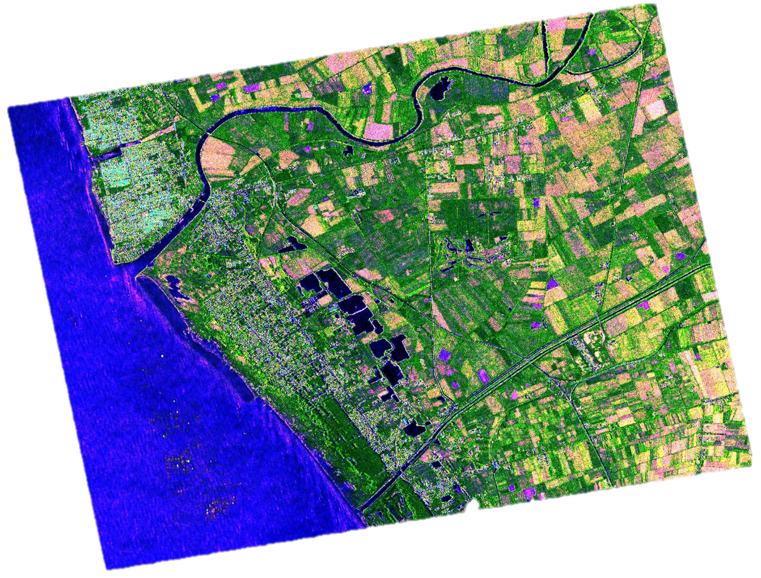
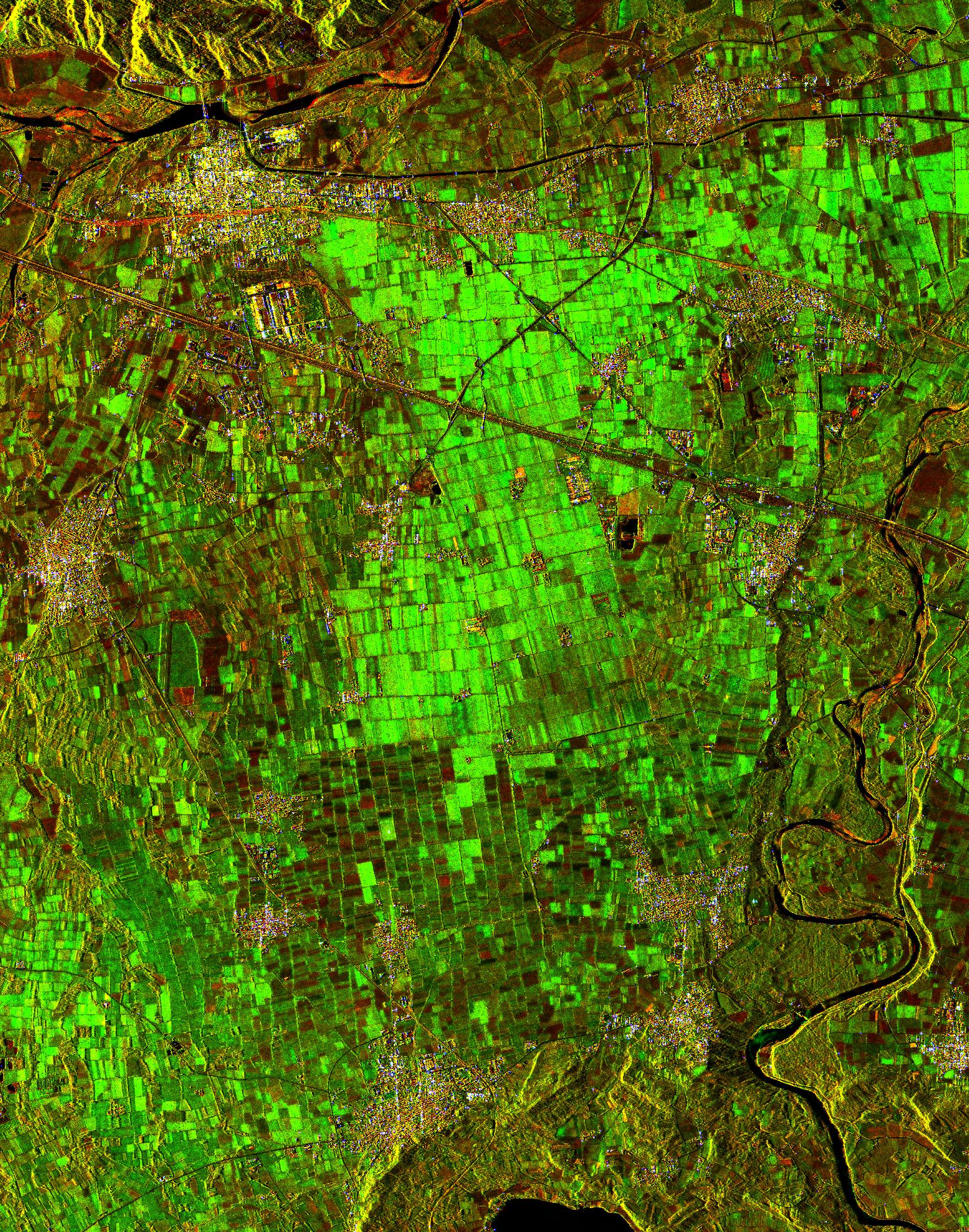
The use of SAR data in applications is still rather limited due to the high technical expertise required to interpret and process data. My research is principally devoted to make data understandable and manageable for non-expert, multidisciplinary users. In this context, I worked a lot on data representation. In fact, SAR data are usually presented to their user in standard SLC gray-scale format. However, humans have a great proficiency for extracting information from color images, which are those they have the habit to deal with in everyday life. Exploiting multitemporal, it was possible to introduce the color representation even in the SAR world. The developed products to constitute an intermediate processing level between the classic Level-1 and Level-2 products. Their principal characteristics are the interpretability, the physical-based association color-object, and the possibility to be treated with simple algorithms for information extraction. Therefore, they are particularly oriented toward the end-user community. Until now, two new classes of multitemporal SAR RGB products have been introduced. Level-1α products, are bi-temporal, change detection-oriented images. Level-1β are classification-oriented images synthesizing the dynamics of N acquisitions of the same scene in a unique color frame. Both Level-1α and Level-1β products have been successfully exploited in several applications, such as classification, urban area mapping, and water resources management. Further research activities concern remote sensing techniques for water resources management in semi-arid environment, satellite-assisted railway monitoring, human vision, data fusion, and machine learning for image classification and object recognition.
I am lucky to work in one of the strongest research group in EM theory and SAR systems worldwide. Its activities began in the early '90s with the development of one of the first and most efficient SAR raw data simulators. From that time, a continuos innovation in EM modeling was performed and testified by tens of works published on the major remote sensing peer-reviewed journals, and several national and international research projects implemented with some of the most important academic and research institutions in the world. Today, beyond EM theory and models, our main research activities concern despeckling, remote sensing data analysis, fusion, and representation, polarimetric SAR, SAR interferometry and differential interferometry, and machine learning.

This project aims to define and propose innovative solutions for railway monitoring. In fact, this structure is subject to a continuous deterioration caused by trains motion and environmental factors (such as earthquakes, subsidence, and storms). The use of SAR systems, thanks to their high resolution, independence from illumination conditions, and short revisit time, can represent a valid support for the monitoring of the infrastructure and of its surrounding landscape through the implementation of ad hoc differential interferometry techniques and innovative change detection approaches. This project is implemented in collaboration with Ansaldo STS, which is one of the biggest worldwide player in railways market. It is founded by the Italian Ministry of University and Research under grant PON03PE_00159_6.

This project aims to promote innovation and development of local railway infrastructures, increasing their security and transportation capacity, through the exploitation of the newest satellite technologies for localization and telecommunication. The project also aims to analyze the possibility of virtualization of some components usually adopted in traditional rail systems. The technological upgrade is expected to increase the overall performance of the system. The technologies constituting the innovative signaling components are based on safe satellite localization systems and on terrestrial communication technologies (2G or 3G), whose infrastructure are fully exploitable without any investment. This project is implemented in collaboration with Ansaldo STS, which is one of the biggest worldwide player in the railway market. It was founded by the Italian Ministry of University and Research under grant PON03PE_00159_4.

Semi-arid regions are characterized by a severe climate, constituted by a short rainy season and long periods of drought. In these areas, small reservoirs are widely employed by local rural communities for water harvesting. They are crucial for population wellness, representing a reserve used for cultivations, livestock, and ordinary consumption during the periods of droughts. However, these objects are not properly monitored, even because they are often built for initiative of local communities, without a governmental coordination. Therefore, even basic information, such as their number, position, and capacity, are often not available. The use of SAR data allows for a cheap and continuous monitoring of the landscape, in a context in which in situ measurements are very demanding. The pilot project was developed in Burkina Faso (Western Africa). It allowed for successfully monitoring the water availability through the synergic use of satellite SAR data and hydrological models. This project was founded by the Italian Space Agency, and implemented in collaboration with the University of Salerno, Fisciano, Italy.
This project concerns the development of a forward looking SAR, i.e. mounted on the nose of an aircraft/spacecraft. This system, scanning an area not yet flied over, is expected to be exploited for guidance and navigation of the platform. The objectives of the projects are the feasibility study, the development simulators and of the required algorithms for real-time processing of highly distorted images. The project is implemented in collaboration with MBDA Italia. It was founded by the Italian Ministry of University and Research under grant PON03PE_00112.
In this page, you can find most of the works I authored or co-authored. They have been published on peer-reviewed journals and proceedings of national and international conferences. Download link to the pre-print version of the works is provided together with, where available, a link to the publisher or the conference website. In case you need material related to these works, please contact me.
In this paper, we present a new framework for the RGB composition of SAR data. The proposed processing chain aims at providing products particularly oriented toward the end-user community, thus characterized by a high degree of interpretability and by the possibility to be processed with simple algorithms for information extraction. The physical rationale of the proposed RGB products is presented through examples highlighting their principal properties. Finally, their suitability with applications is demonstrated through two activities dealing with urban area and land cover mapping.
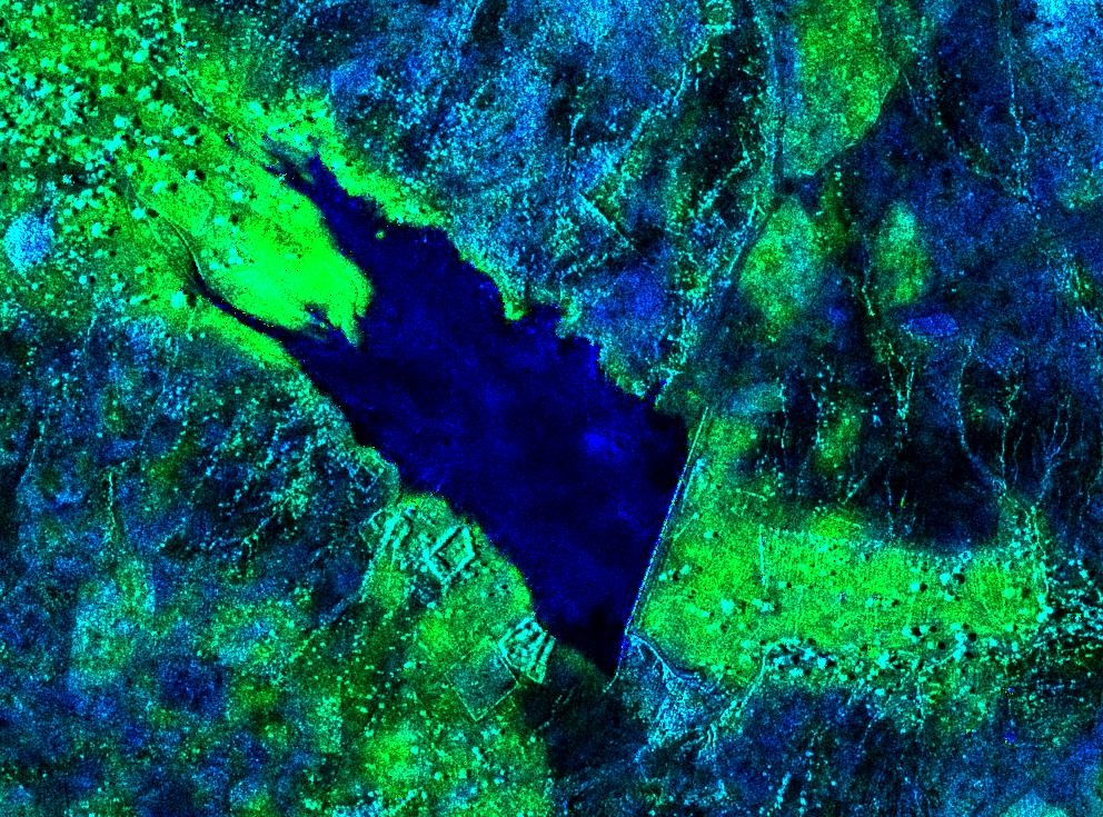
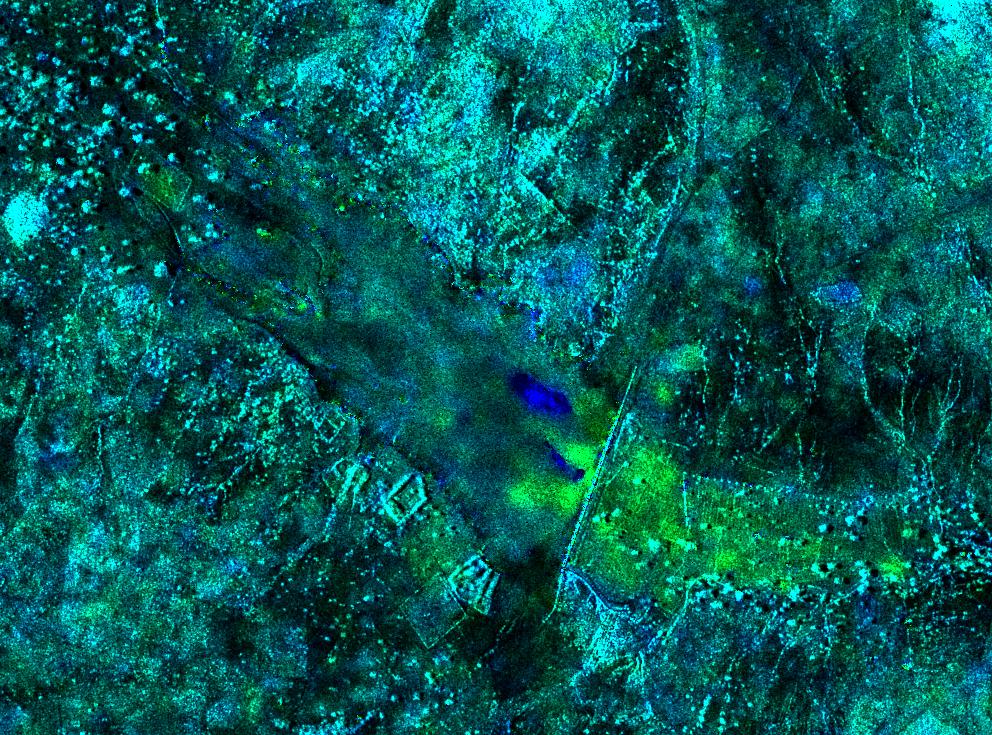
In this paper, we introduce an innovative method to map small reservoirs in semi-arid environment. The proposed technique is based on the exploitation of the recently introduced Level-1α RGB SAR composite, and it is based on change detection. In particular, we introduce a user-oriented water index defined by a weighted ratio of the bands composing the RGB product. The performance of the method are evaluated by comparison with other popular segmentation techniques of the same complexity in order to demonstrate its reliability. Finally, an applications concerning hydrology, i.e the estimation of reservoir bathymetry starting from area measurements, is presented to underline the usefulness of remote sensing in multidisciplinary contexts.
Earth observation technologies can provide a significant contribution to the monitoring urban areas and critical infrastructures. In this paper, we show how to exploit the recently introduced multitemporal SAR RGB images of the Level-1α and Level-1β family in these applications. Simple, ad hoc algorithms are discussed to adapt these generalist products to the specific case study. In particular, self-organizing map clustering and object-based image analysis are used for urban area mapping. As for infrastructure monitoring, an application concerning railway monitoring is discussed.
In this paper, we test the capability of satellite synthetic aperture radar (SAR) images to enhance the monitoring of river geomorphological processes. The proposed approach exploits the recently introduced Level-1α products. These products are bi-temporal RGB composites in which the association color-object, being physical-based, is stable whatever the scene is considered. This favors the detection of temporary rivers' characteristics for classification purposes in a change-detection environment. The case study was implemented on the Orco river (northwest Italy), where a set of 39 COSMO-SkyMed SAR stripmap images acquired from October 2008 to November 2014 was used to monitor channel planform changes. This preliminary study is devoted to assess the suitability of Level-1a images for geomorphologist, with particular reference to the detection of phenomena of interest in river monitoring. This is prior for semi-automatic or automatic classification activities.
In this paper, we introduce a new framework for the RGB representation of SAR data. The purpose is to lower the expertise required to manage data, providing intermediate products between the classic Level-1 and Level-2. These products are particularly oriented toward the end-user community. In fact, their principal characteristics are interpretability, reproducibility and possibility to be processed with simple algorithms, widely available in the most popular software suites. The proposed framework and products are discussed through examples in which the above-mentioned properties are highlighted. Finally, their suitability in applicative contexts is demonstrated through two example concerning classification activities, implemented exploiting both pixel-based and object-based techniques.
In this paper, we present an innovative, human-centered framework for color-coding of multitemporal SAR images. The objective is to provide ready-to-use images for applications and characterized by a high degree of interpretability, even for non-expert users, and the possibility to be processed with simple, end-user-oriented algorithms for information extraction.
In this paper, we present a new framework for the generation of two new classes of RGB products derived from multitemporal SAR data. The aim of our processing chain is to provide products characterized by a high degree of interpretability (thanks to a consistent rendering of the underlying electromagnetic scattering mechanisms) and by the possibility to be exploited in combination with simple algorithms for information extraction. The physical rationale of the proposed RGB products is presented through examples highlighting their principal properties. Finally, the suitability of these products with applications is demonstrated through two examples dealing with feature extraction and classification activities.
In semi-arid regions, small reservoirs are widely employed for facing seasonal in water availability due to the alternation of a short rainy season and of a very long dry season. Therefore, their monitoring is fundamental for local rural communities wellness. In this paper, we present a novel framework for water resources management exploiting the synergy of synthetic aperture radar (SAR) data and hydrological models. The pilot project was implemented in Burkina Faso, showing good potentialities for cheap and continuous monitoring of the environment through the exploitation of a multi-disciplinary framework.
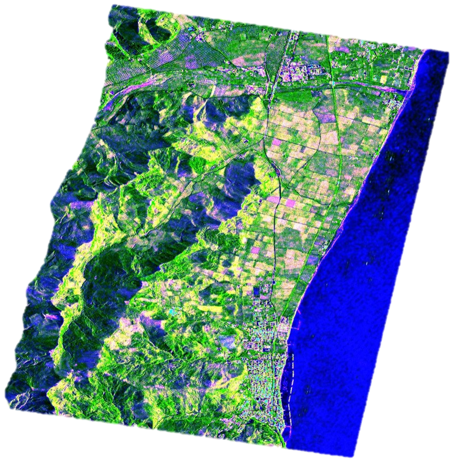
In this paper, we present a new framework for the fusion, representation, and analysis of multitemporal synthetic aperture radar (SAR) data. It leads to the definition of a new class of products representing an intermediate level between the classic Level-1 and Level-2 products. The proposed Level-1β products are particularly oriented toward nonexpert users. In fact, their principal characteristics are the interpretability and the suitability to be processed with standard algorithms. The main innovation of this paper is the design of a suitable RGB representation of data aiming to enhance the information content of the time-series. The physical rationale of the products is presented through examples, in which we show their robustness with respect to sensor, acquisition mode, and geographic area. A discussion about the suitability of the proposed products with Sentinel-1 imagery is also provided, showing the full compatibility with data acquired by the new European Space Agency sensor. Finally, we propose two applications based on the use of Kohonen’s self-organizing maps dealing with classification problems.
In this paper, we present a technique for improving the representation of built-up features in model-based multitemporal synthetic aperture radar (SAR) RGB composites. The proposed technique exploits the multitemporal adaptive processing (MAP3) framework to generate an a priori information which is used to implement an adaptive selection of the coherence window size. Image texture is used to support the coherence information in case of decorrelation. The coherence information, powered by texture analysis, and combined with backscattering amplitude, provides a unique representation of built-up features. This allows for an immediate detection of urban agglomerates by human operators, and is an advantaged starting point for urban area extraction algorithms.
In this paper, we present an end-user-oriented framework for multitemporal synthetic aperture radar (SAR) data classification. It accepts as input the recently introduced Level-1α products, whose peculiarities the high degree of interpretability and the increased class separability with respect to single grayscale images. These properties make the Level-1α products very attractive for the application of simple supervised classification algorithms. In fact: i) the high degree of interpretability of the maps makes the training phase extremely simplified; ii) the good separation between the classes allows for obtaining excellent results using simple discrimination rules. It results in a simple, fast, accurate and repeatable framework.
The use of remote-sensing images is becoming common practice in the fight against environmental crimes. However, the challenge of exploiting the complementary information provided by radar and optical data, and by more conventional sources encoded in geographic information systems, is still open. In this work, we propose a new workflow for the detection of potentially hazardous cattle-breeding facilities, exploiting both synthetic aperture radar and optical multitemporal data together with geospatial analyses in the geographic information system environment. The data fusion is performed at a feature-based level. Experiments on data available for the area of Caserta, in southern Italy, show that the proposed technique provides very high detection capability, up to 95%, with a very low false alarm rate. A fast and easy-to-use system has been realized based on this approach, which is a useful tool in the hand of agencies engaged in the protection of territory.
This paper presents the Multitemporal Adaptive Processing (MAP3) framework for the treatment of multitemporal Synthetic Aperture Radar (SAR) images. The framework is organized in three major activities dealing with calibration, adaptability and representation. The processing chain has been designed looking at the simplicity, i.e. the minimization of the operations needed to obtain the products, and at the algorithms availability in literature. Innovation has been provided in the cross-calibration step, which is solved introducing the Variable Amplitude Levels Equalization (VALE) method, through which it is possible to establish a common metrics for the measurement of the amplitude levels exhibited by the images of the series. Representation issues are discussed with an application-based approach, supported by examples regarding semi-arid and temperate regions in which amplitude maps and interferometric coherence are combined in an original way.
In this paper we explore the performances and the opportunities provided by the European satellite Sentinel-1 for water resource management applications in low-income countries. The analysis is supported by a synthetic aperture radar (SAR) simulator, which allowed the quantification of the expected characteristics of Sentinel-1 products in three applications: interferometric digital elevation models (DEMs) generation, land cover mapping and estimation of water volumes retained by small reservoirs. The obtained results quantitatively show that Sentinel-1 data characteristics are fully suitable for most of the application already explored in the recent SAR literature.
We propose a new approach for remote sensing data exploration, based on a tight human–machine interaction. The analyst uses a number of powerful and user-friendly image classification/segmentation tools to obtain a satisfactory thematic map, based only on visual assessment and expertise. All processing tools are in the framework of the tree-structured MRF model, which allows for a flexible and spatially adaptive description of the data. We test the proposed approach for the exploration of multitemporal COSMO-SkyMed data, that we appropriately registered, calibrated, and filtered, obtaining a performance that is largely superior, in both subjective and objective terms, to that of comparable noninteractive methods.
In this paper we propose a methodology devoted to exploit the outstanding characteristics of COSMO-SkyMed for monitoring water bodies in semi-arid countries at a scale never experienced before. The proposed approach, based on appropriate registration, calibration and processing of Synthetic Aperture Radar (SAR) data, allows outperforming the previously available methods for monitoring small reservoirs, mainly carried out with optical data, and severely limited by the presence of cloud coverage, which is a frequent condition in wet season. A tool has been developed for computing the water volumes retained in small reservoirs based on SAR-derived digital elevation model. These data has been used to derive a relation between storage volumes and surface areas which can be used when bathymetric information are unavailable. Due to the lack of direct measures of river’s discharge, the time evolution of water volumes retained at reservoirs has been used to validate a simple rainfall-runoff hydrological model which can provide useful recommendation for the management of small reservoirs. Operational scenarios concerning the improvement of the efficiency of reservoirs management and the estimation of their impact on downstream area point out the applicative outcomes of the proposed method.
This paper presents an efficient framework and a sustainable pilot project on the effective use of spaceborne Synthetic Aperture Radar (SAR) in low income countries and semi-arid climatic contexts. The technical efficiency was pursued by integrating SAR models and hydrological assessment methods; the socioeconomical sustainability was guaranteed by the joint work of scientists, technicians and volunteers. The pilot project was developed in the Yatenga region, a Sahelian area in northern Burkina Faso. In particular, an original development of SAR Interferometry algorithms was tailored to the peculiar climate, the soil characteristics, and the land-cover of the semi-arid regions. A digital elevation model (DEM) was derived and an original approach based on the use of SAR amplitude images is proposed for its validation. The achieved DEM resolution (9m) is significantly better than that of the previously available DEMs in the study area (30m). Based on the DEM, the soil sedimentation rate of small reservoirs has been estimated together with the average soil-loss in the contributing catchments due to the erosion process. A multi-temporal filter was implemented on the SAR images for monitoring of water intake volume in small reservoirs, and its seasonal evolution. The developed tools provide an innovative contribution for the improvement of water resource management in the study area. This approach is repeatable and scalable to suit situations with similar economic and climatic conditions.
In this paper, we present an innovative framework for RGB composition of multitemporal SAR data. The proposed products improve users’ experience with data enhancing interpretability and allowing for information extraction using simple techniques. The characteristics of the RGB products are illustrated through examples in which their suitability with several applications is highlighted.
In this paper we propose a methodology devoted to exploit high resolution radars for monitoring water bodies in semiarid countries. The proposed approach is based on appropriate registration, calibration and processing of SAR data, producing information ready to use by end-users. The obtained results were used to (i) estimate a relationship between surface and volume of water stored in reservoirs and (ii) validate a hydrological model that simulates the time evolution of water availability.
In this paper, we present a new framework for high level processing of time series images, with particular reference to Sentinel-1 data. The proposed methodology has the goal of enhancing the interpretation of SAR imagery through the production of physical-based RGB composites, which are particularly suited for being easily interpreted by the human photointerpreter, lowering the expertise level required for managing SAR data.
In this paper, we introduce an innovative methodology for urban areas extraction based on a new class of multitemporal colour composite products. As first, we propose a method for enhancing the coherence characteristic of the image adapting the dimension of the main window to the scene target. Thus, we show how to link this property with a colour attribute, which is combined with textural information to form the final fuzzy urban areas map.
In this paper we introduce a feedback system for the enhancement of urban areas in Level-1α multitemporal RGB composite. In particular, our method focus on the interferometric coherence, whose estimator performances depends on the dimension of the computation window. The proposed method allows for the mitigation of this problem, reducing speckle and increasing the resolution and the accuracy of the output maps through the generation of an adaptive window, bringing benefits also in the process of buildings extraction.
Monitoring soil erosion and consequent reservoirs sedimentation is necessary for a proper planning of water and soil conservation measures. Applicability to large scale and cheapness of the monitoring system is crucial for low income countries. The present work proposes a novel approach in which remote sensed SAR and Landsat data are used for monitoring reservoir’s sedimentation and for mapping the soil erosion risk at catchment scale. Novel techniques for SAR imagery preprocessing are combined with empirical soil loss estimates. A SAR derived DEM is used to monitor the soil sedimentation rate of small reservoirs. The USLE (Universal Soil Loss Equation) method is used to draw a soil erosion risk map and to roughly estimate the total soil loss at catchment scale.
In this paper we propose a GIS-based methodology, using optical and SAR remote sensing data, together with more conventional sources, for the detection of small cattle breeding areas, potentially responsible of hazardous littering. This specific environmental problem is very relevant for the Caserta area, in southern Italy, where many small buffalo breeding farms exist which are not even known to the productive activity register, and are not easily monitored and surveyed. Experiments on a test area, with available specific ground truth, prove that the proposed systems is characterized by very large detection probability and negligible false alarm rate.
In this paper we present an innovative approach for interpretation, processing and representation of multi-temporal SAR images. The proposed approach includes three blocks of activities concerning data calibration, adaptive processing and user-based representation. The knowledge of electromagnetic models guides the production of RGB products, whose interpretation does not require specific expertise in remote sensing. The method is presented with the support of a case study concerning the production of land cover maps in a rural context.
In this paper we present the Multitemporal Adaptive Processing (MAP3) framework for the definition of a new family of multitemporal, user-oriented products whose information level lays between those of the already available Level-1 and Level-2 products. This framework is organized in three blocks of activities dealing with pre-processing, adaptive processing and representation. Experiments performed on semiarid and temperate datasets testify the reliability of the proposed framework and its independence from the sensor and the scenario.
In this paper we propose a methodology devoted to exploit high resolution radars for monitoring water bodies in semiarid countries. The proposed approach is based on appropriate registration, calibration and processing of SAR data, producing information ready to use by end-users. The obtained results were used to (i) estimate a relationship between surface and volume of water stored in reservoirs and (ii) validate a hydrological model that simulates the time evolution of water availability.
We address the problem of SAR despeckling by resorting to nonlocal filtering guided by an optical image. In fact, given the increasing availability of remote-sensing optical images, it makes perfect sense trying to use them to improve the performance of despeckling. Our technique exploits the optical image to reliably estimate the statistical similarity among pixels, which is used to evaluate the weights of nonlocal filtering. Optical data are not used to estimate SAR values, but only to guide the overall process. In addition, they are discarded altogether in regions where SAR and optical images present different local geometries, identified by a preliminary classification step, avoiding thus any additional distortion. Experimental results show the proposed approach to provide images of better quality than state-of-the-art conventional filters.
Reliable segmentation of SAR images requires some forms of user supervision: we resort here to the interactive version of the Tree-Structured Markov Random Field (TS-MRF) segmentation suite. The TS-MRF model, and the associated segmentation tool, provide a flexible and spatially adaptive description of the data. In the interactive version, the user can drive the process based on the inspection of the current result, deciding step-by-step which direction to take, and switching from one segmentation modality to another. Experiments with the segmentation and classification of multitemporal SAR images prove the potential of the interactive approach and of the TS-MRF tool.
In this paper we present the Multitemporal Adaptive Processing (MAP3) paradigm devoted to the definition of new multitemporal, user-oriented products. MAP3 is organized in three blocks of activities dealing with pre-processing, adaptive processing and representation. Experiments performed on different scenarios testify the reliability of the proposed paradigm and its independence from both sensor and scene.
In this paper we present the available products and the future opportunities derived by the use of Synthetic Aperture Radar data for humanitarian projects. A set of images relevant to an area of the Sahel, in Burkina Faso have been used for supporting the proposed claims. Along with the technical problems related with the image interpretation, we focus on the economic accessibility of the data, that mainly limited the use of SAR images in low income countries. The future availability of free access data makes their use very attractive, provided that appropriate knowledge is available for interpreting the images.
High resolution SAR data can be a powerful support mainly in areas where the acquisition of in situ information is hampered by physical or economic obstacles. Purpose of this paper is to present an approach to exploit high resolution SAR data for monitoring the temporal evolution of reservoir characteristics in semi-arid regions. Classical and innovative techniques are tailored on the specific climatic conditions of these regions, characterized by the alternation of a three months wet and a nine months dry seasons. Results from a case study developed in Burkina Faso show that the combined use of amplitude and phase information allows the estimation of the eroded areas and a meaningful monitoring of the reservoirs sedimentation.
This is the summary of my teaching activities, both academic and as tutor for training courses in private enterprises.
Lecturer for a 34-hours course on remote sensing and synthetic aperture radar data processing. The course has been supplied to MBDA Italia scholarship fellows under the aegis of the project “TELEMACO - Formazione di personale di ricerca esperto di Tecnologie abilitanti e sistemi innovativi a scansione elettronica del fascio in banda millimetrica e centimetrica per applicazioni radar a bordo di velivoli” (PON03PE_00112).
D. Amitrano, New Perspectives for Multitemporal SAR Data Analysis: Representation, Understanding, and Value-Added Products, Remote Sensing Colloquium, University of Zurich, Zurich, Switzerland, 28 March 2017.
D. Amitrano, Telerilevamento e cambiamenti climatici, FabSpace 2.0 Training Courses, ESA BIC Lazio, Rome, Italy, 26 October 2017.
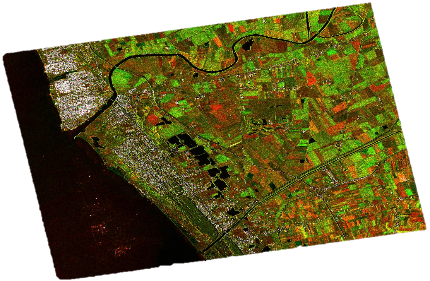
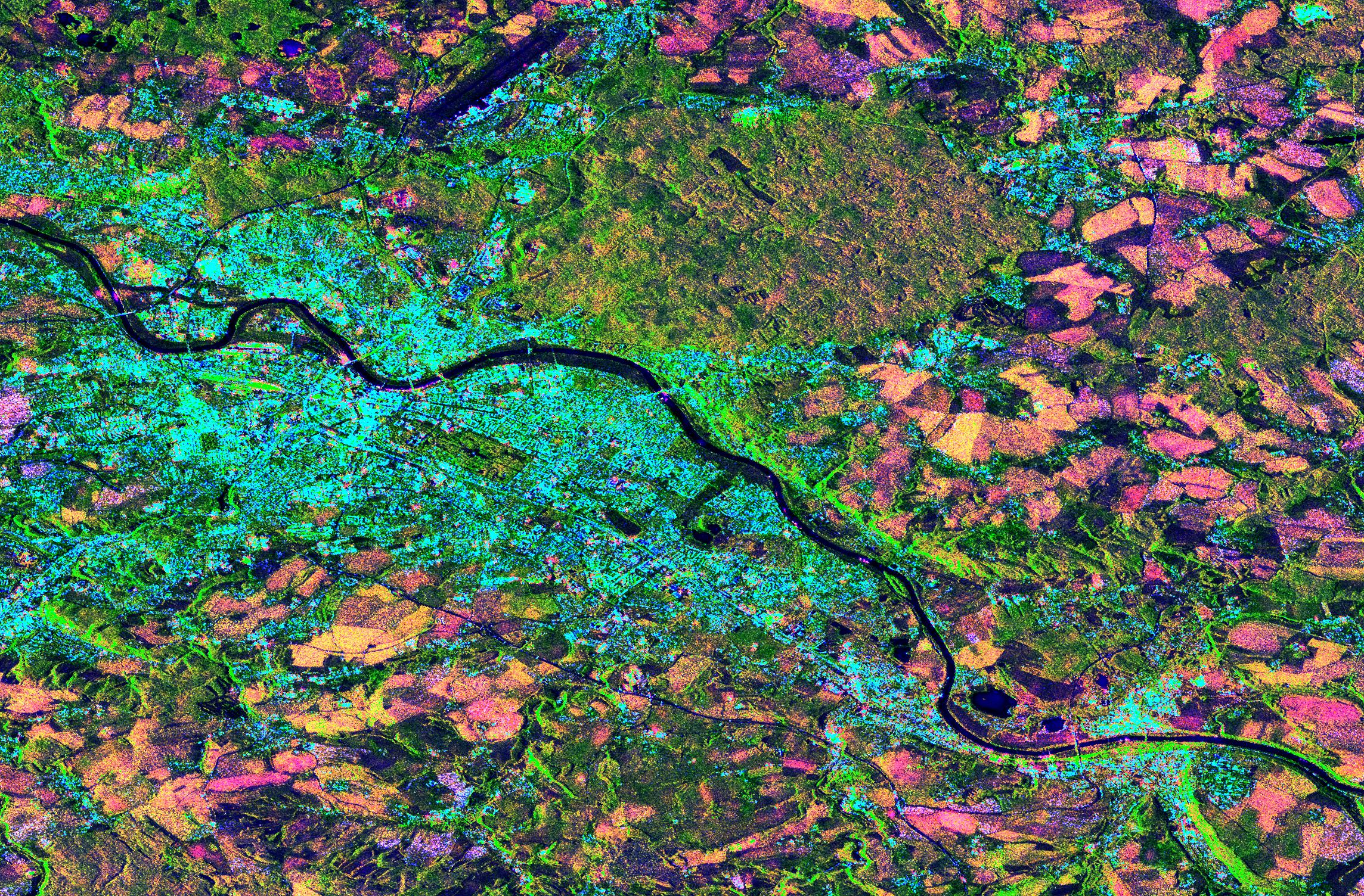
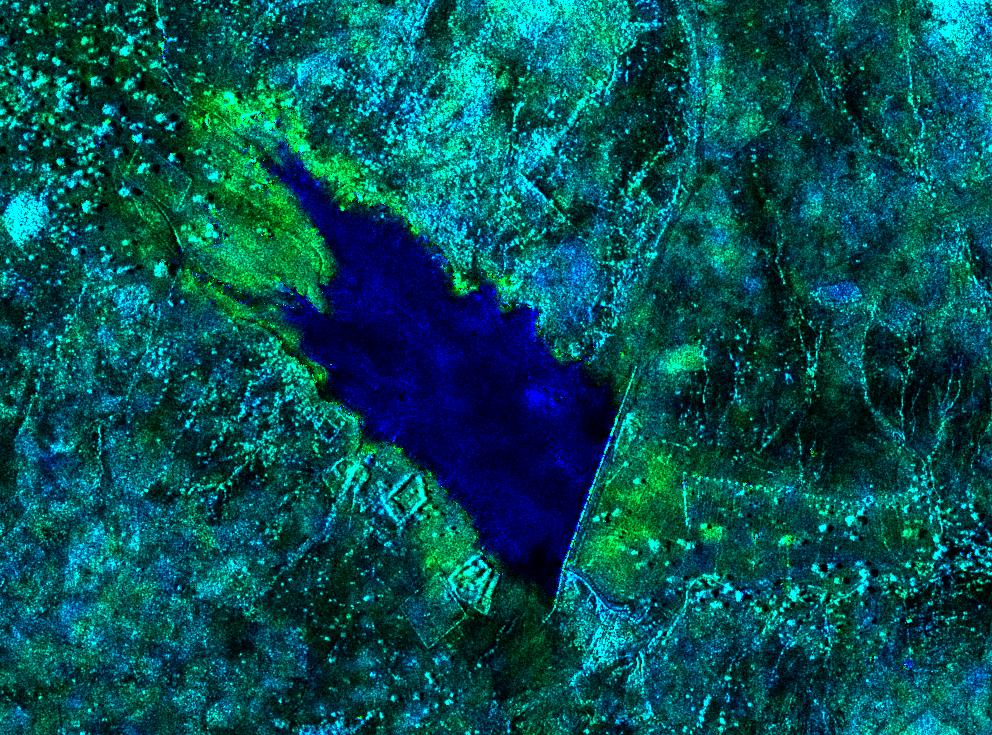
In this page, you can find some example of the products designed by my research group. Images are in low resolution, compressed, standard image format. If you need a processable (i.e. binary) version of them, please look at the section "Codes & Data" of this website. If the image you are looking for is not available on that page, or if you have specific requests, please contact me.
In this page, you can find some data and codes I produced in my research activity. Data are provided in binary ENVI-like format, i.e. accompanied by a header file specifying the basic information about the file (dimensions, datatype, interleave, and so on). If you are using MATLAB, these data can be read exploiting the multibandread command. Codes are mainly written in MATLAB (.m) or IDL (.pro) language. Note that running IDL codes requires the installation of the AstroLib library. In case you need other material not published on this page, please contact me.
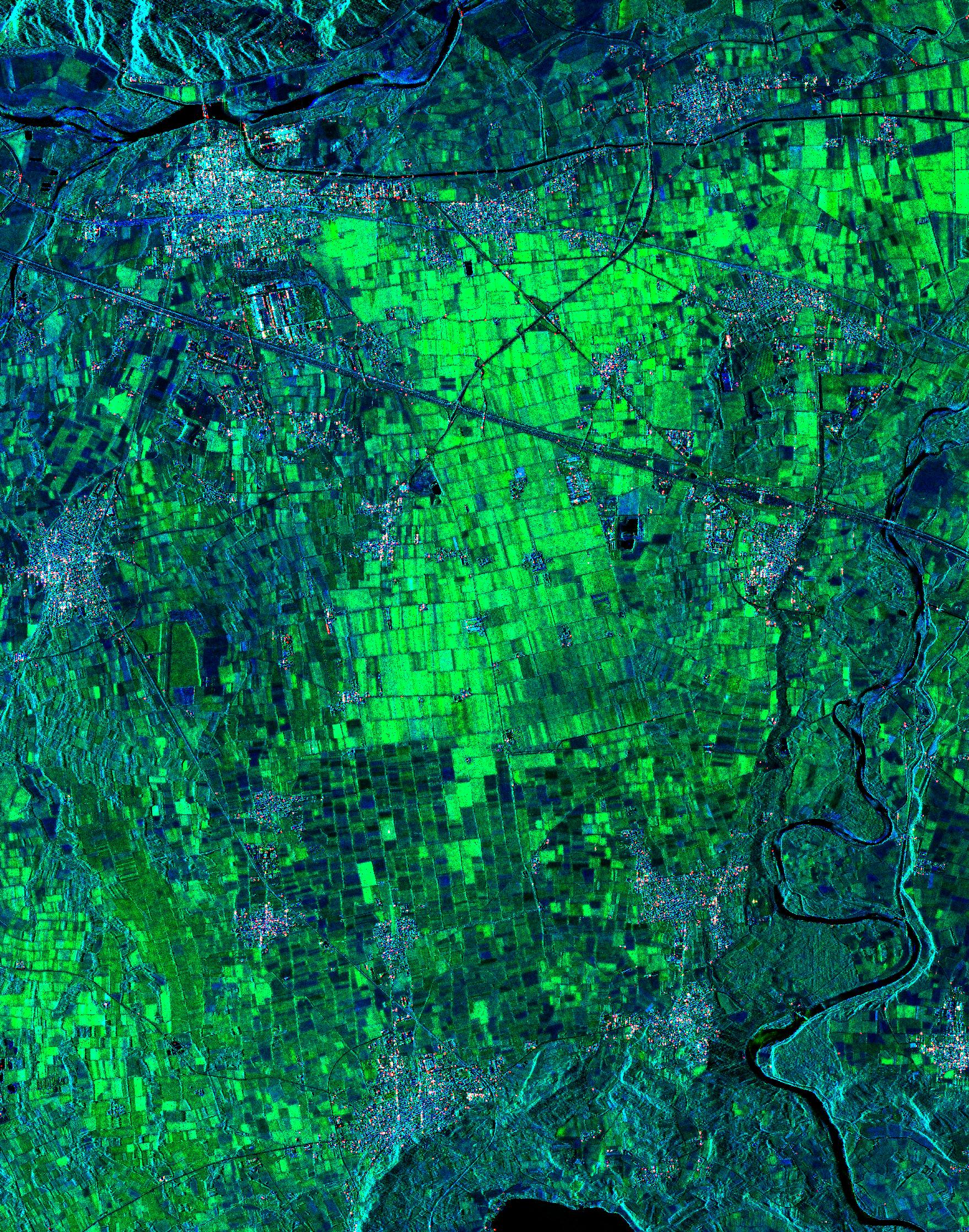
This package includes a Level-1β product of the Dresden area built using 6 Sentinel-1 images acquired between October and December 2014 and its corresponding 5-class land cover map obtained through self-organizing map clustering of the input RGB product.
Reference D.Amitrano, F. Cecinati, G. Di Martino, A. Iodice, P.-P. Mathieu, D. Riccio, G. Ruello, "Multitemporal Level-1β Products: Definitions, Interpretation, and Applications", IEEE Transactions on Geoscience and Remote Sensing, vol. 54, no. 11, pp. 6545-6562, November 2016
This package includes the codes implementing a mode filter for post-classification activity. The filter substitutes the central pixel of a moving window with the mode computed in the window itself. Vectorization and tiling are implemented to optimize computational time and to manage large images.
Reference D.Amitrano, G. Di Martino, A. Iodice, D. Riccio, G. Ruello, "An end-user-oriented framework for the classification of multitemporal SAR RGB images", International Journal of Remote Sensing, vol. 37, no. 1, pp. 248-261, January 2016
My office is located at the Engineering Faculty, Via Claudio 21, 80125 Napoli, Italy, Building 2, First floor, Room 1.13. I would be happy to talk to you if you need my assistance in your research. In this case, please send me an e-mail, or use one of the channels indicated on this website.
The University of Naples Federico II is the oldest state and laical academic institution in the world. It was founded by Federico II of Swabia, Holy Roman Emperor and King of Naples and Sicily in 1224. Today, it counts about 80k students enrolled in about 150 courses of study, representing one of the biggest universities in Europe.
I am with the Department of Electrical Engineering and Information Technology. It offers 7 Bachelor's degree and 7 Master's degree courses enrolling thousand of students. Research activities cover several scientific fields such as electromagnetics, informatics, bioengineering, robotics and signal and image processing. If you are interested in a PhD in these subjects please visit the dedicated website.
“I am leaving. I shall not forget Via Toledo, nor any other of the parts of Naples; to my eyes this city has no equal and is the most beautiful city in the universe." Stendhal, Rome Naples and Florence (1817)
Naples is the largest city of southern Italy for number of inhabitants and the third in the country after Rome and Milan. Its story begins with ancient Greeks who founded the city of Neapolis in the VIII century b.C., which was one of the most important cities in the ancient world thanks to its strategic position within the Mediterranean Sea. After the fall of Rome, the city was strongly contended and governed by several dinasties. They highly contributed to its growth and leaved important historical evidences, making Naples one of the cities with the highest density of monuments worldwide. Naples reached its acme under the Bourbons between 1734 and the unification of Italy in 1860. In this period, it was one of the most important and evolved European capitals, together with London and Paris.
Naples is worldwide famous for its food, traditions and history. Since 1955, the historical center of the city (with its treasures like the Veiled Christ, the Trasure of San Gennaro, and the countless churches) is included in the UNESCO World Heritage List. Naples is a must-see for everyone coming in southern Italy, and the starting point for visiting the Amalfi coast, the ruins of Pompeii and Hercolaneoum, and Capri.
The city is served by an efficient airport connected with the most important European cities and by an high speed railway ensuring quick links with Rome (one hour) and Milan (four hours).